Submitted by Geoff Moore
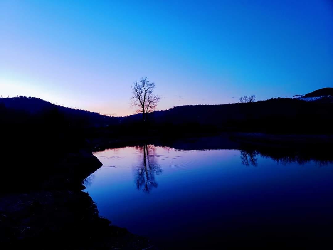
Submitted by VisitNorthIdaho.com
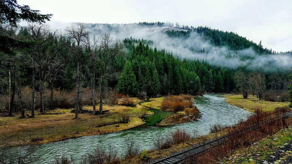
Submitted by VisitNorthIdaho.com
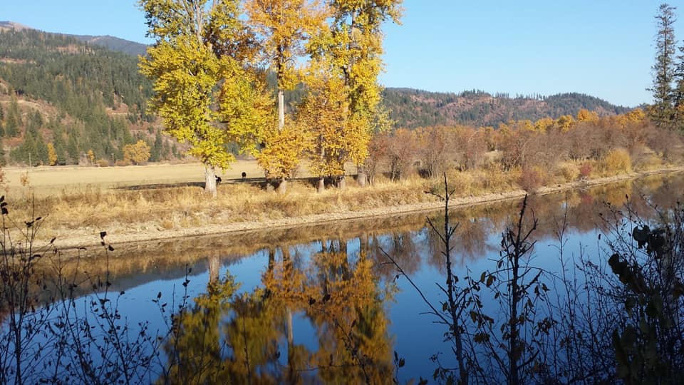
Submitted by Nancy J Ridenour-Matteson
Nancy J Ridenour-Matteson
Nancy J Ridenour-Matteson
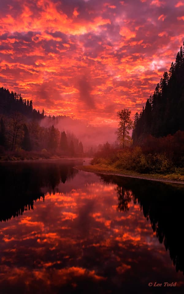
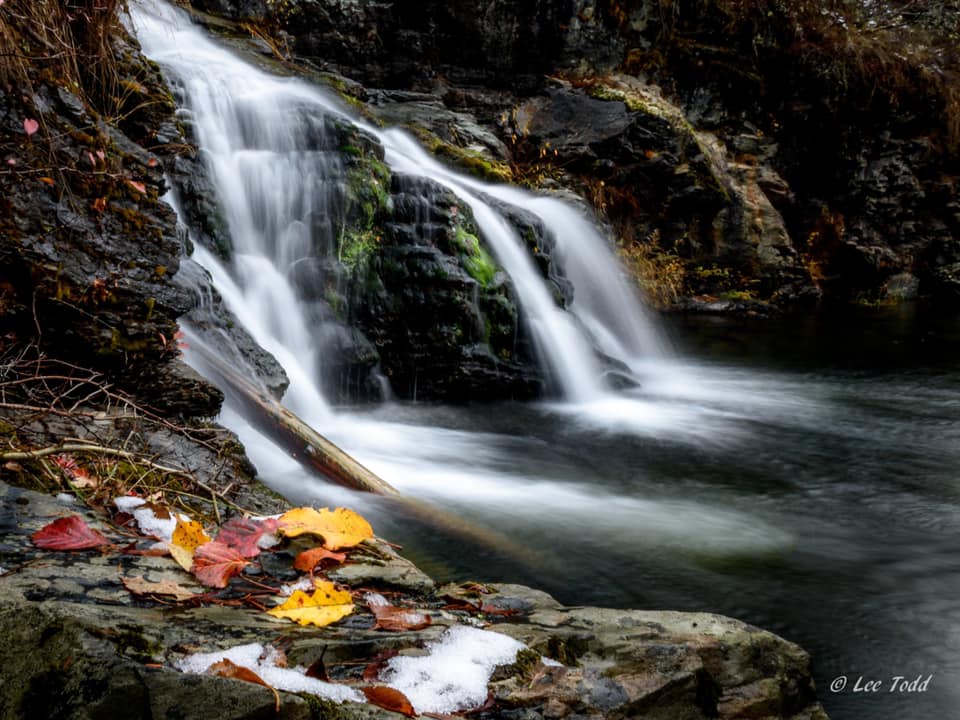
Submitted by Lee Todd Photography
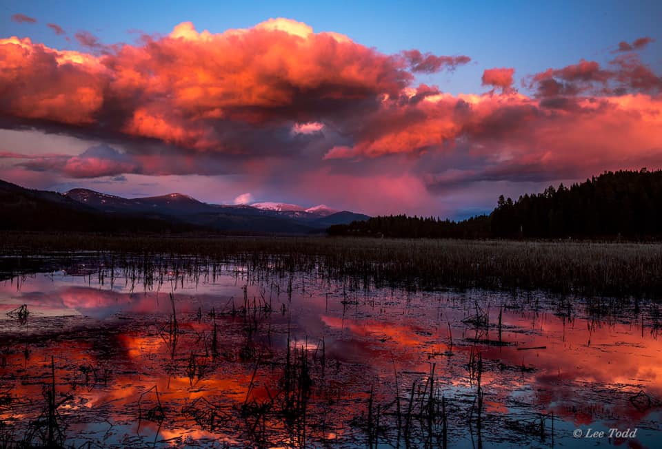
Submitted by Lee Todd Photography
Submitted by Lee Todd Photography
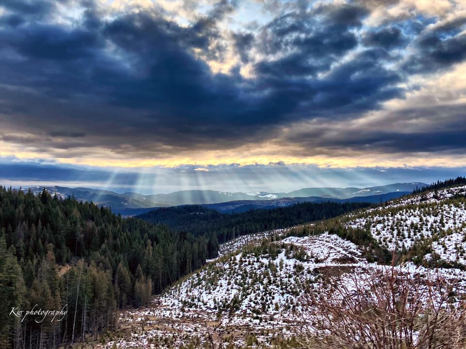
Submitted by KW Photography
Submitted by Jayme Kachelmier
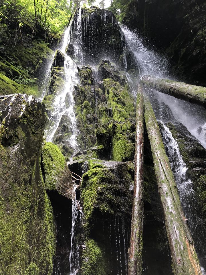
Submitted by Harvey Photography
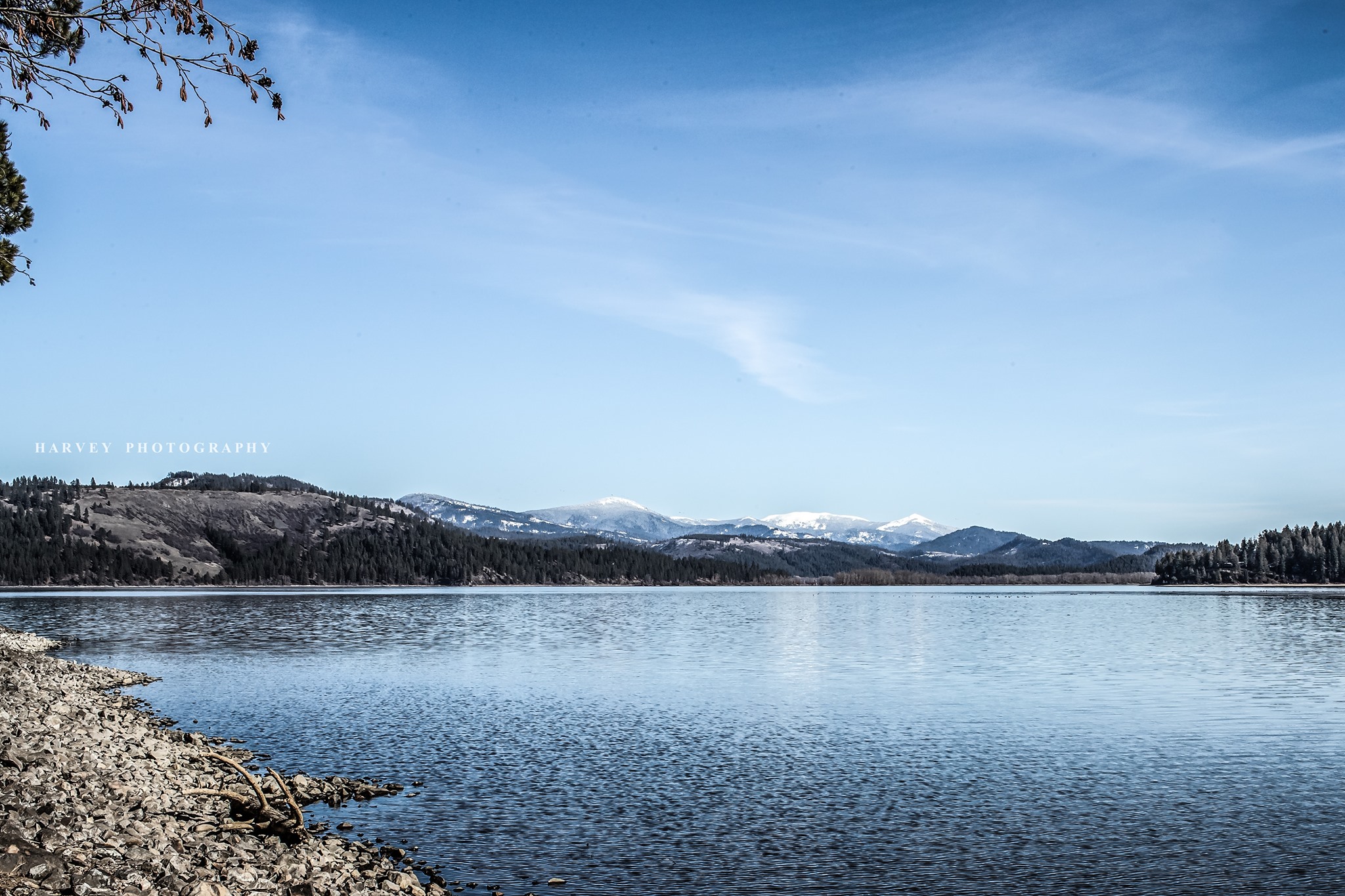
Submitted by Harvey Photography
Submitted by Harvey Photography


FISHING & HUNTING
A number of small lakes, streams and rivers surround St. Maries, provides a variety of fish, assuring fisherman their quotas of bass, trout, kokanee, salmon, northern pike and perch. Dawn to dusk are prime times to fish from spring to fall. Where to fish is a tough choice.
Take a scenic drive above St. Joe City “The Joe” becomes shallower, faster and the water is clear. Here you can catch Dolly Vardens, rainbow, cutthroat and other species of trout. The upper St. Joe River above or below Avery is where the best fly-fishing is found.
Locals claim the St. Joe River may have the best cutthroat trout fly fishing in the U.S. The St. Joe is a beautiful freestone river that originates at St. Joe Lake high on the western slope of the Bitterroot Range along the Montana – Idaho border. More than 50 miles of the upper river glide through lush northwestern forest and are managed as catch-and- release water. Only flies and artificial lures with single barbless hooks are allowed. Of the 50-plus miles of catch-and-release water, the lower 33 miles, from the mouth of Prospector Creek upstream to the Spruce Tree Campground, are paralleled by road. From Spruce Tree upstream, the river is roadless, but paralleled by a hiking trail for about 17 miles. On summer weekends anglers hit the roadside water in considerable numbers. If you want to enjoy excellent cutthroat fishing in solitude, backpack into the roadless area. Most of the lakes along the St. Joe and Coeur d’Alene Rivers offer a mix of bass, pike and panfish.
Seasonal fishing events stack up faster than the logs behind the mill booms along the St. Joe River. Third week in April: Pike fishing derby – restricted to chain lakes between Rose Lake and Harrison. Boaters and shore anglers compete on an equal level. Memorial Day: Annual fisherman’s breakfast, same morning as opening date of trout season. Mid May: Squawfish derby – prizes for biggest fish, most caught, junior and senior citizen divisions. Registration fee required. Must fish within the St. Joe, St. Maries Rivers and Coeur d’Alene drainage to Post Falls Dam to qualify.
The Idaho Department of Fish and Game can provide details on fishing seasons and regulations. Compulsive fisherman can find guides and information on the St. Joe River and other hot spots to cast your line at our local sporting goods stores and tackle shops.


St. Maries, located on the St. Joe River, offers some of the finest outdoor recreation opportunities available anywhere. The St. Joe River Valley has a well-deserved reputation as being one of the finest elk hunting areas in the United States.
The St. Joe National Forest, which supports the third largest elk herd in North America, is popular with big game hunters. For that reason, hunters from throughout the nation travel to St. Maries every year to take advantage of this area’s large and growing elk herd.
Besides being one of the nation’s premier elk-hunting areas, the St. Maries area also offers deer, bear and moose hunting. Duck, turkey, pheasant, grouse and geese abound for the bird hunter.
The Idaho Department of Fish and Game can provide more details on hunting seasons and regulations.

CAMPGROUNDS

With miles of hiking and bicycle trails, lake access for boaters and waterfowl hunter and abundant wildlife, Heyburn State Park remains a prized possession of Idaho’s residents and visitors alike. Created in 1908, the park is the oldest in the northwest. The 100-year-old park was named in honor of Senator W.B. Heyburn of Idaho who was instrumental in the acquisition of the park, created from the Coeur d’Alene Indian Reservation by an act of Congress on April 20, 1908. The deed, signed by President William Howard Taft, granted 5,505 acres of land and 2,333 acres of water to the state.
Three lakes and a river, Chatcolet, Benewah and Hidden lakes and the shadowy St. Joe River are included within the park’s boundaries. Chatcolet Lake is a small area at the southern tip of Coeur d’Alene Lake. It was once a lake by itself, but the dam at Post Falls turned it into part of the bigger, better-known Coeur d’Alene. It also has the added feature of having the St. Joe River in its midst.
The park has a lot to offer; tour the Trail of the Coeur d’Alenes or plan an afternoon picnic. The park has four group picnic shelters built by the Civilian Conservation Corps, three of which can be reserved for an event ($35 plus tax) by contact park staff at 208-686-1308.
There is a $5 fee assessed per day, per vehicle, and annual passports are available for $40 per calendar year.


Cedar Ridge
Three miles north of Clarkia on State Three. There are three camp sites three picnic sites, vault toilet, no drinking water. Fee: $6 for camping. Day Use free. Fishing in the St. Maries River.
Emerald Creek Campgrounds
The campground is located near the Emerald Creek Garnet Area. Hobo Cedar Grove and Lines Creek Interpretive Trails for day trips from the campground. Take State 3 south from Fernwood, six miles to Emerald Creek Rd. 447. Turn right and follow the signs 4.8 miles to the campground. Open May 15 to Sept.15. 18 Campsites, drinking water, vault toilets, rock-hounding.

Shadowy St. Joes Campground: Take State Three out of St. Maries .6 mile to the St. Joe River Rd. Drive 10.8 miles east to campground sign. Fourteen Campsites, wheelchair accessible, drinking water, vault toilets, boat ramp and docks, fishing. Fee: $6, Day Use free. Picnic Shelter (can be rented for groups)

Huckleberry Campground: BLM campground five miles east of Calder on the St. Joe River; 39 RV sites; 50′ maximum length. Open April 1 to Nov. 30. Pull through sites, hookups, drinking water, handicap access, vault toilets, pets allowed, dump station included. Boating, fishing, river rafting. Tents welcome.


Marble Creek: 35 miles east of St. Maries on St. Joe River Rd. FH-50. Five picnic sites, displays tell the story of early logging in the Marble Creek drainage. Six picnic tables and vault toilets. Fishing access. Wheelchair accessible site.
Upper Landing Picnic Area: One mile east of Avery on St. Joe River Road (FH-50) picnic shelter with 6 tables and 4 other picnic sites, info kiosk, water, fishing and hiking. Adjacent RV dump station.

Turner Flats: Eight miles east of Avery on the St. Joe River Rd. Eleven campsites, drinking water, vault toilets, hiking, fishing, rafting. Stock allowed in two sites with feed bunks. Fee: $6


Tin Can Flats, Avery: Ten miles east of Avery on the St. Joe River Rd. Eleven campsites. Drinking water, vault toilets, hiking, fishing, kayaking, rafting. Fee: $6

Packsaddle Campground: Six miles east of Avery on St. Joe River Road. Two sites for tents/campers, with vault toilet, hiking, fishing and rafting. No water
Conrad's Crossing: Twenty-eight miles east of Avery on the St. Joe River Rd. (FS Rd. 50). Eight Campsites, drinking water, vault toilets, hiking, fishing, rafting.

Fly Flas Campground, Avery: Pack in/pack out campground 29 nine miles east of Avery on the St. Joe River Rd. Turn right across the bridge on Red Ives Rd. 218 and go 3.4 miles to campground, 14 campsites. One pull-through stock only site and stock allowed in five other sites. The Red Ives visitor center and historical site is seven miles away. Drinking water, vault toilets, hiking, fishing, kayaking.


Beaver creek Campground: Twenty-nine miles east of Avery on the St. Joe River Rd., then 8 miles on Red Ives Rd. 218. Two tent/camper/small trailer campsites, vault toilet, fishing, hiking. No water.

Red ives Ranger Station: Twenty-nine miles east of Avery on the St. Joe River Rd., then 10 miles on Red Ives Rd. 218. Visitor information, water, vault toilet. The station is on the National Historic Register.
Line Creek Stock Camp, Avery: Twenty-nine miles east of Avery on the St. Joe River Rd., then 11 miles on Red Ives Rd. Nine pull-through units for stock trailers. Feed bunks, hitch posts, vault toilets, hiking, fishing. No drinking water.

Spruce Tree Campground Area, Avery: Twenty-nine miles east of Avery on the St. Joe River Road, then 12 miles on Red Ives Rd. Nine campsites, drinking water, vault toilets, hiking, fishing. End of the road and the start of St. Joe River Trail 48.

Gold Flat Camping Area: Meadow camping area, good for groups. Vault toilet, fishing, hiking. No water.
Scott Park: This RV and boat campground is about 14 miles east of St. Maries up the St. Joe River Road at milepost 14 near St. Joe City. There is a fire pit, picnic table, boat launch and camping by donation. Pack in/pack out. Outhouse, no drinking water.
Heller Creek Campground: This RV and boat campground is about 14 miles east of St. Maries up the St. Joe River Road at milepost 14 near St. Joe City. There is a fire pit, picnic table, boat launch and camping by donation. Pack in/pack out. Outhouse, no drinking water.


Mammoth Springs Campground: 22 miles east of Avery on St. Joe River Road FH-50, then 14 miles south on Bluff Creek Road 509, turn south 2.5 miles on Road 201. Six campsites, vault toilets, drinking water, stock area and water trough, vault toilet. Hiking, one mile from Dismal Lake, approx. 5 miles from Snow Peak Trailhead.

Big Creek CAmpgrounds: Five miles east of Calder on County Rd. 347; four miles northwest on Big Creek Rd. 537. Nine Campsites, vault toilets, drinking water, fishing, hiking, dirt bikes, horseback trails.
CCC Camp, Calder: Five miles east of Calder on County Rd. 347; three miles northwest on Big Creek Rd. 537. Meadow camping area, good for groups. Vault toilet, Fishing, hiking, dirt bikes, horseback trails. No water.

Telichpah Campground, Avery: (formerly North Fork Joe Campground) Six miles north of Avery on the North Fork of the St. Joe Rd. (FS Rd. 456). Fifteen campsites, five that can accommodate trailers/RVs. Ten sites for tents and pick-up campers. Vault toilets, no potable water. Hiawatha Bicycle Trail Hiking, fishing.
Camp 3 Campground:35 miles east of St. Maries on FH-50, then 15 miles south (left) on Marble Creek Road 321. Four campsites, stock area, vault toilet, historic cabin. No water.
Hobo Historic Trail: 35 miles east of St. Maries on FH-50, then 18 miles south (left) on Marble Creek Road 321. Vault toilet, trail with interpretive signs, steam donkey, and other artifacts.
WINTER SPORTS
Here In North Idaho,
We love playing in the snow!
North Idaho has the snow and terrain to create a snowmobile paradise. Snowmobiling is one of the area’s fastest growing sports. Because St. Maries is located in the Bitterroot Mountains, ski areas and snowmobiling opportunities are plentiful. In winter months snowmobiling enthusiasts delight in miles of groomed trails and good snow. There are over 600 acres available just outside St. Maries for snowmobiling. Christmas Hills Recreation area is located approximately 2 miles east of St. Maries; it has a warming hut, restrooms and unloading docks. Potlatch Corp recreation permits are not required to ride at Christmas Hills Recreation area.
North Idaho gives winter sport enthusiasts every opportunity to experience Idaho’s winter beauty at developed ski resorts and a network of groomed trails. Downhill skiers and boarders can challenge Idaho’s legendary powder at Silver Mountain (home of the world’s longest single stage gondola) in Kellogg. Silver Mountain added a tubing hill in 2006 that’s popular with the whole family.
Lookout Pass Ski Area (the best learning hill in the Northwest and a phenomenal value for beginners) is on the Montana-Idaho border near Wallace. It’s a sack lunch style and home-town hospitality that make this the local area family favorite.

Cross country skiing is a great way to enjoy the beautiful outdoors at a leisurely pace. A wide variety of terrain awaits. A catalog of Nordic trails is available from the Idaho State Department of Parks & Recreation. Call 208-769-1511 or http://www.idahoparks.org. The Park N’ Ski Pass is $25 (plus tax) and allows you to park and ski at 11 back country sites across the state. Passes can be purchased at regional offices of the Idaho Department of Parks and Recreation, as well as most cross country ski shops statewide.
Strapping on a pair of snow shoes and making first tracks in fresh snow on a sunny winter day is as good as it gets for North Idaho outdoor recreation. The winter wonderland scenery around St. Maries makes your snow shoe experience worth your while. Don’t forget to bring a camera! Depending upon snow conditions, accessibility may be limited to the back country areas.
Sustained temperatures below the freezing mark are required to create ice that’s thick and safe enough for ice fishing on local lakes. Many of the smaller lakes in the area do freeze over most every winter.
RIVER AND STREAMS: The Winter Stream Season will allow die-hard anglers to continue to catch-and-release trout through March 31 and harvest whitefish and brook trout. The list of rivers open during the winter include the Clark Fork River below the RR bridge, North Fork, Little North Fork and mainstream Coeur d’Alene rivers, St. Joe River, St. Maries River and the Moyie River.
COEUR D’ALENE LAKE: Winter can be a great time to fish for smaller Chinook. Winter anglers typically use glow flashers and mini squids on a relatively long leader. The fish are usually below 60 feet where the water temperature is slightly warmer once the lake reaches winter stratification.
Ice Fishing: Sustained temperatures below the freezing mark are required to create ice that’s thick and safe enough for ice fishing on local lakes. Many of the smaller lakes in the area do freeze over most every winter.
For over thirty-five years the US Pacific Coast Championship Sled Dog Race has been held at Priest Lake. Each year 75 to 100 teams from around the country and as far away as Alaska and Canada gather on the west side of the lake for the competition. 509-447-5744 or Inland Empire Sled Dog Association
Surrounding Benewah and Shoshone counties, the miles and miles of trails are endless for snowmobiling. A history of timber and mining has left an extensive network of trails through the Idaho Panhandle National Forest. Snowmobiling regulations and trail maps are available from U.S. Forest Service offices throughout the region. With the eminent success of snowmobiling projects throughout North Idaho, here’s a recommendation: Make plans for your visit before the rest of the world gets here!
MOTOCROSS & ATV
MotoCross & ATV
Motor-cross enthusiasts delight in the miles of groomed trails offered by St. Maries. There are over 1400 acres available just outside St. Maries for motor-cross. In surrounding Benewah and Shoshone counties, the miles and miles of trails are endless for motor-cross and ATV riding in the summer.
GOLFING
The St. Maries Golf Course - The city’s challenging, panoramic 9-hole golf course is on par with any fine golf course anywhere. The St. Maries Golf Course is in a beautiful setting with paved golf cart trails, a club house, and restaurant.
ON THE WATER
The finest recreational opportunities are plentiful in this incredibly beautiful area of rivers and lakes. Some of the best boating and water recreation anywhere can be found in St. Maries on the St. Joe River, St. Maries River, Coeur d’Alene Lake and its “chain lakes” surrounding the area.
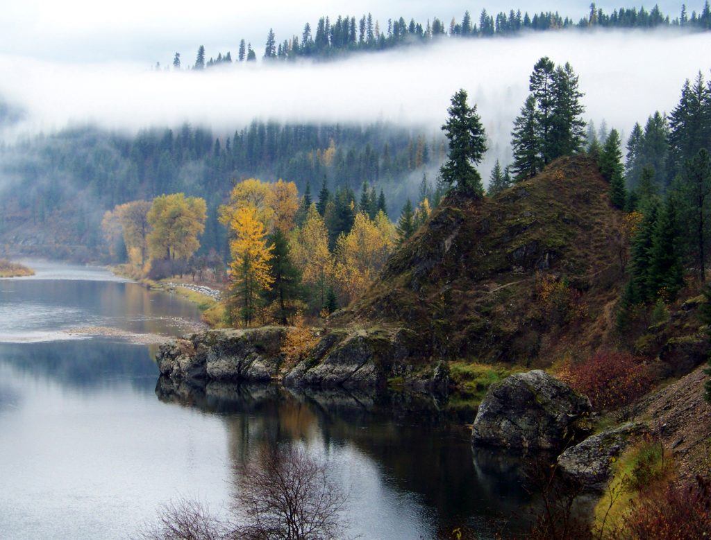
The fact that this vast water system is set in some of the country’s most beautiful scenery makes this system unparalleled. St. Joe River, the highest navigable river in the world, is a free flowing 120 miles offering adventures from white water rafting to peaceful float trips. White water enthusiasts will find the upper St. Joe a challenge. The St. Maries River is a good spring run for rafting and kayaking. The whitewater is gentle and the surrounding forests are beautiful. This run goes through a secluded canyon with a thick pine forest providing many opportunities to view wildlife.
The “shadowy St. Joe River,” is named for the towering Cottonwoods which adorn the shore lines. Recognizing the abundance of this area’s resources, the Forest Service has invested in improving its recreation sites and campgrounds in the St. Joe River area. All along the river adventure awaits you. Boat ramps at St. Maries Aqua Park make it easy to launch your boat on the St. Joe River. A day on the water can include kayaking, water skiing or cruising on the St. Joe River or the St. Maries River. Cherry Bend boater’s park is an excellent picnic location and home to many community events
BICYCLING
The Route of the Hiawatha – A Scenic Mountain Bike Trail that runs along the Old Milwaukee RR bed, opens on May 26th!*The trail is open 7 days a week through September 23rd. Trail hours are 8:30 am to 5 pm.
America’s greatest adventure begins high atop the Bitterroot Mountains along the Idaho/Montana border when you enter the massive 1.66 mile long St. Paul/Taft Tunnel, built in 1908! When you emerge, you follow the historic rail trail which incorporates; 10 cavernous train tunnels and crosses 7 sky-high trestles. Riders and hikers will venture past sparkling mountain creeks; deer, elk and moose; and enjoy endless views of the towering ID/MT Bitterroots. All this on a section of trail described as “the most scenic stretch of RR in the country.”
The Trail is located midway between Spokane, WA and Missoula Montana, yet garners guests attention from all across America and the globe. Guests, both local and international, start by visiting Lookout Pass Ski Area – getting off I-90 at exit 0 on the ID/MT line. Here they pick up trail passes, rental bikes, helmets, bright lights, maps, water and snacks, before traveling five miles east to Exit #5 in Taft, MT. From here it’s another two miles up a dirt road to the Trailhead where your first order of business is to pedal through the longest of the tunnels the St. Paul / Taft Tunnel. Look for a historical marker on the tunnel wall about half way through and learn which side bored through the fastest and how accurate they were in joining up in the middle. Remember all the engineering was accomplished by hand without the aid of computers.
The trail has been described as “The Crown Jewell of Rail-to-Trail Conservation in the Country", and was chosen as a *USA Today Top Ten Pick as well as being inducted into the Rail-to-Trail Hall of Fame. This all downhill ride is appropriate for individuals and families of all ages. Children ages 5 and up who know how to ride a bike have indeed finished this trail on fixed speed bicycles
What Makes this bike trail different: Let me count the ways: 15 mile all downhill ride from Taft, MT to Pearson, ID, shuttle bus available to transport you and your bike back to the top, incredible RR history, majestic scenery including snow covered mountains, abundant wildlife, you’ll ride in two states crossing from MT into ID, one of the most unique Rails-to-Trails conversions in the country, 7 sky-high trestles, 10 dark tunnels which require powerful lights to ride through safely, a waterfall, 47 interpretive historical signs, and best of all it’s all family and kid friendly. Learn more: www.RideTheHiawatha.com
Lookout Pass is easy to get to: Travel I-90 to Exit 0 on the ID/MT Line. We’re just 200 yards off the exit ramp. www.SkiLookout.com |Phone: 208.744.1301 | The Route of the Hiawatha Trailhead is just another 5 miles east to exit #5 off I-90 and then two more miles up a dirt road to the East Portal of the long Taft Tunnel.
Lookout Pass Ski & Recreation area operates the Route of the Hiawatha under a special use permit from the USFS. A small usage fee is charged to all users: Trail passes are $11 for adults, and $7 for kids ages 6 to 13 years of age.
The Trail of the Coeur d’Alenes is one of the most spectacular and popular bike trails in the western United States. The Trail of The Coeur d’Alenes nearly spans the Panhandle of Idaho as it runs along rivers, beside lakes and through Idaho’s historic Silver Valley. Much of the trail today follows the original Union Pacific rail line, giving it a gentle grade. Here, you will find 73 miles of newly laid asphalt that’s perfect for road bikers and in-line skaters. The uniqueness of the trail isn’t simply the beautiful scenery and attractions along its route, but it’s an innovative solution to the environmental problems caused by the early miners in the Valley
EMERALD CREEK GARNETS
Please Note: The St. Joe Ranger District schedules the Emerald Creek Garnet Area to open in May the Friday before Memorial Day and closes after Labor Day. Please check this website before you visit the garnet area for further updates.
"THERE ARE ONLY TWO PLACES IN THE WORLD YOU CAN FIND STAR GARNETS - INDIA AND RIGHT HERE ON THE IDAHO PANHANDLE NATIONAL FORESTS!"
The Emerald Creek Garnet Area, an area managed by the U.S. Forest Service, is a popular recreation site open to the public for the purpose of searching for star garnets. Due to concerns for water quality, aquatic habitat, and public safety, the operation now uses sluice boxes for recovery of the Idaho state gem
The area is still in the same location as before the revamping of the operation. While visitors will no longer be digging for garnets in the stream bed, the new method still allows people to enjoy the thrill of discovery. A photo gallery on the Forest Service website shows the steps one takes to get from gravels to garnets. Screen boxes, buckets, and shovels are provided
From St. Maries, Idaho, follow Highway 3 south 24 miles to Road 447. Proceed southwest 8 miles on Road 447 to the parking area. Information, and the sluice area are a 1/2 mile hike up 281 Gulch. Detailed instructions and maps are located on the Forest Service website.
For those who are unable to make the walk should call the Clarkia office (208-245-1134) and make arrangements for someone to open the gate. Or, they can have someone walk up to the sluice site and have an employee go down and open the gate. A handicap placard, handicap license plate, or some other proof of disability is required for this service.
9 A.M. to 5 P.M. Friday through Monday (Note tickets are not available onsite, and must be purchased in advance)
CLOSED Tuesday throught Thursday
The Garnet Area closes for the season Labor Day
Permits can be purchased online at https://www.recreation.gov/ticket/facility/10086846?tab=info or by calling (877) 444-6777 or TDD (877) 833-6777 Adults: $15 Children ages 6-12: $5 Children under 6: Free. Recreation.gov charges a $1 processing fee on each transaction A mineral permit is issued for each individual. Limit of 5 lbs of garnet per day; 6 permits per year.
You are provided: buckets, shovels, and special screen boxes
You should bring:
- Drinking water, snacks, and/or lunch
- Sunscreen
- Container for garnets (recloseable plastic bags work well)
- Some items other visitors have found useful are:
- Lined, rubber gloves
- Small hammer
- Small brush
- Collapsible stool
GUIDELINES: Pets are not allowed. Motorized equipment is not allowed in the Garnet Area
Emerald Creek Campground 4 miles east of the Garnet area. Fee is $6.00 per night per unit
Cedar Creek Campground 3 miles north of Clarkia on HWY 3. Fee is $6.00 per night per unit
Clarkia Work Center Guest Bunkhouse Rental on HWY 3 in Clarkia. (call: 208-245-1134 or 208-245-2531 for rental information)
Food, gas, and other supplies are available in Clarkia (6 miles), Fernwood (12 miles), and Emida (25 miles)
Laundromats in Fernwood and St. Maries
The nearest safe drinking water is in the Emerald Creek Campground.

