Submitted by Geoff Moore
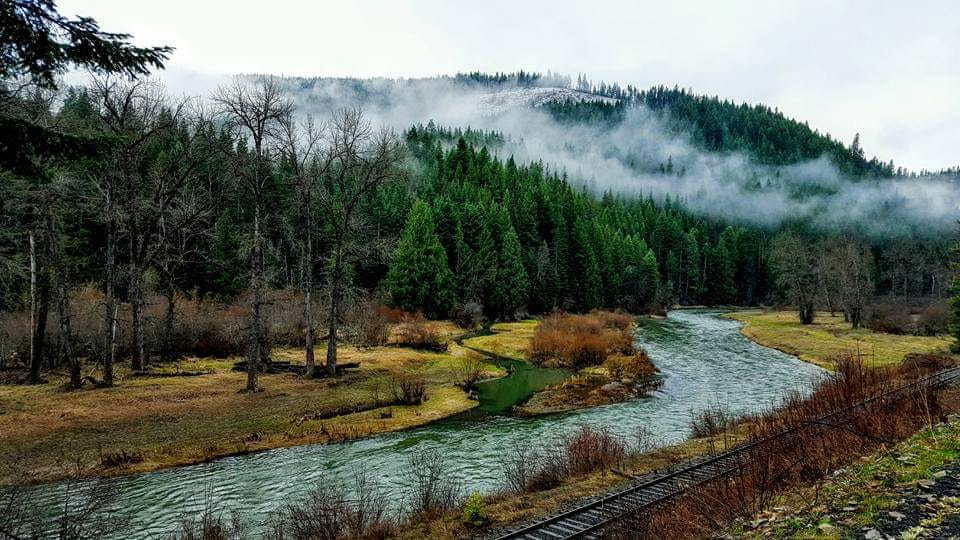
Submitted by VisitNorthIdaho.com
Submitted by VisitNorthIdaho.com
Submitted by Nancy J Ridenour-Matteson
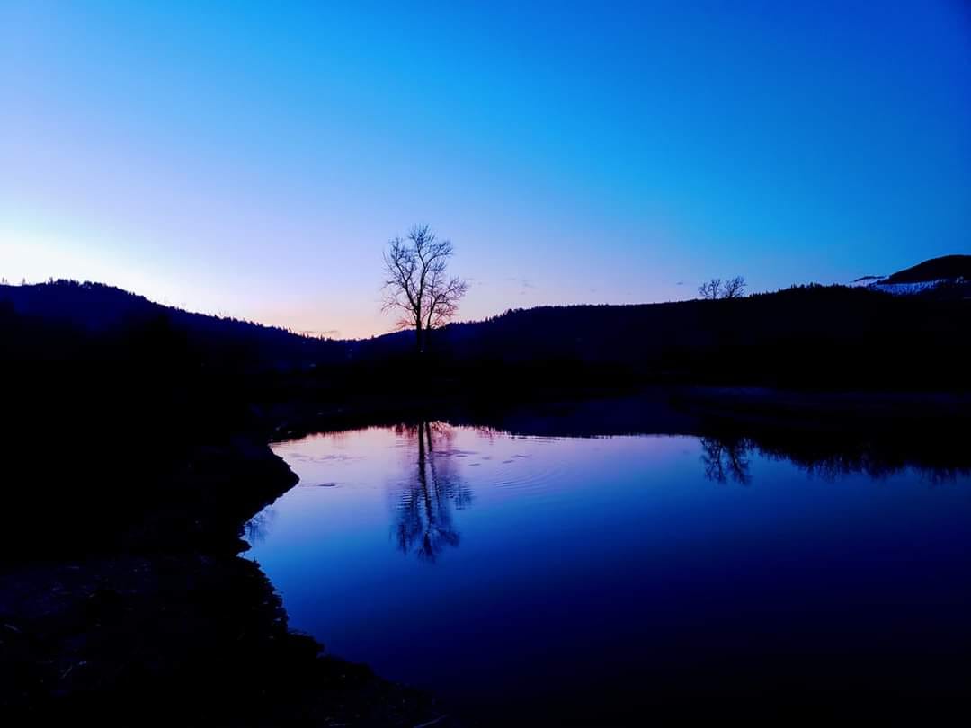
Nancy J Ridenour-Matteson
Nancy J Ridenour-Matteson
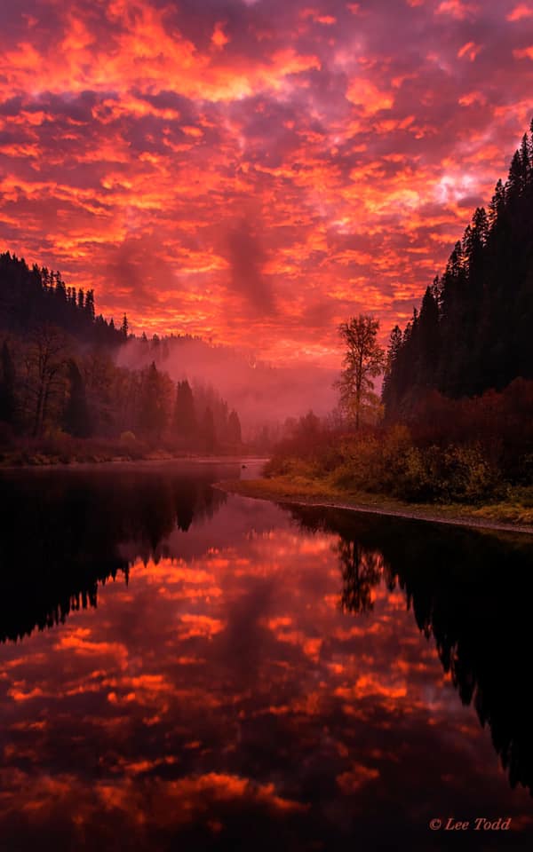
Submitted by Lee Todd Photography
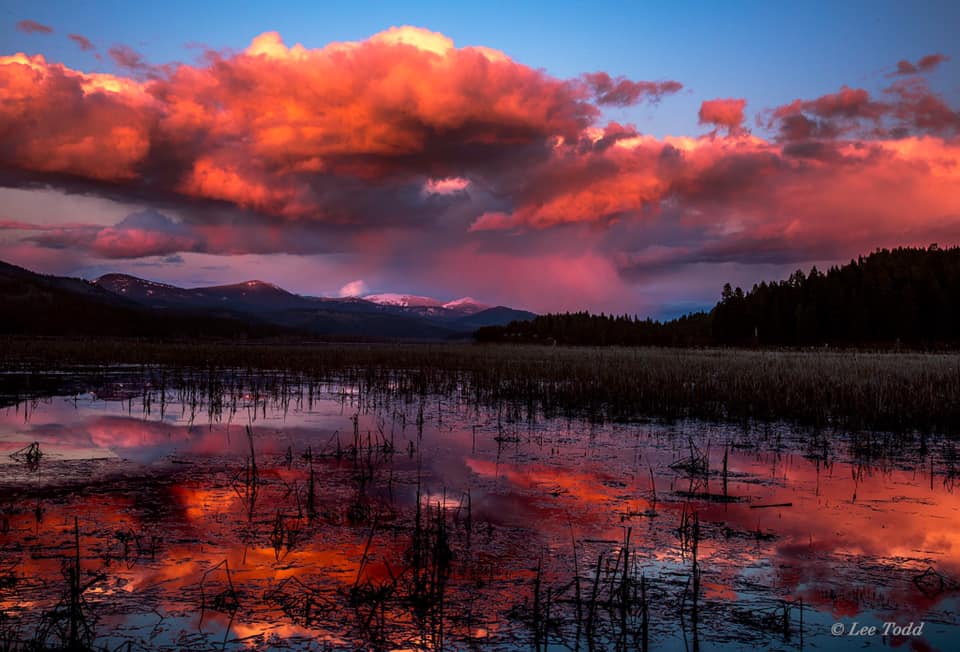
Submitted by Lee Todd Photography
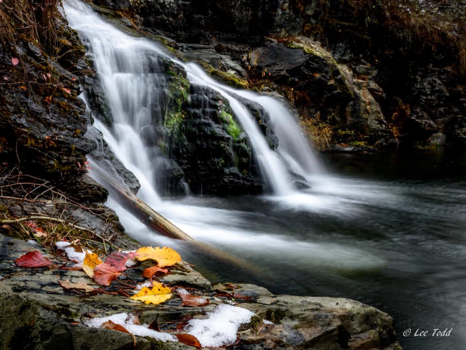
Submitted by Lee Todd Photography
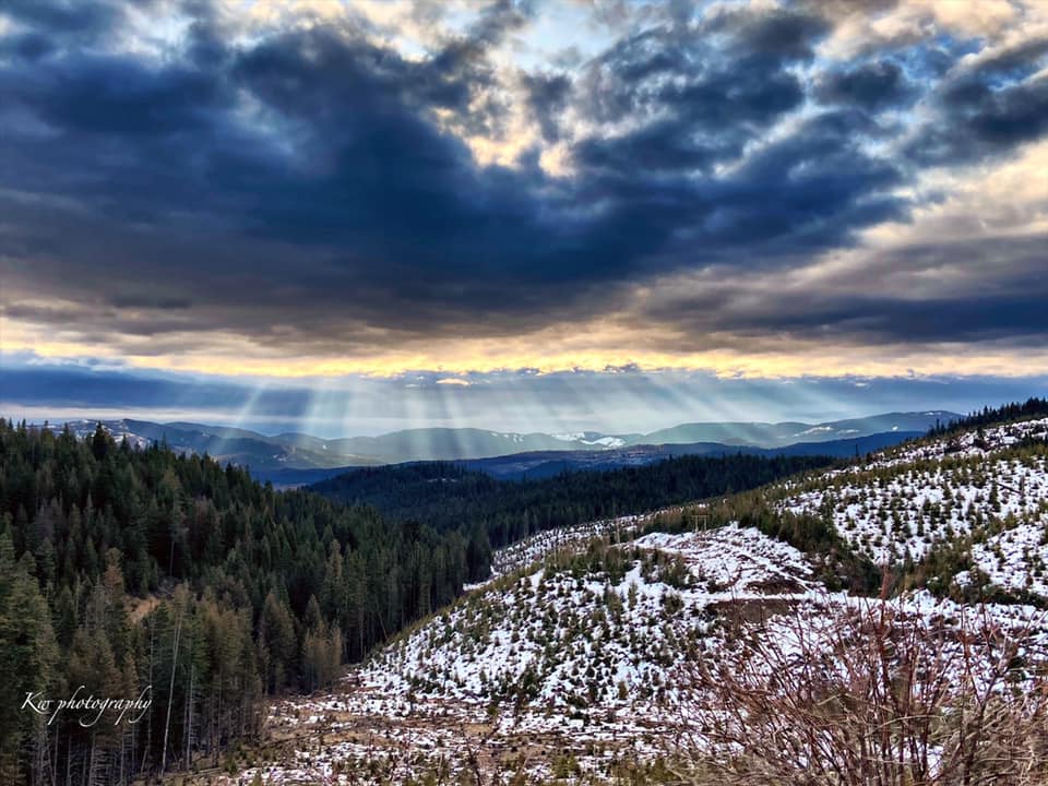
Submitted by KW Photography
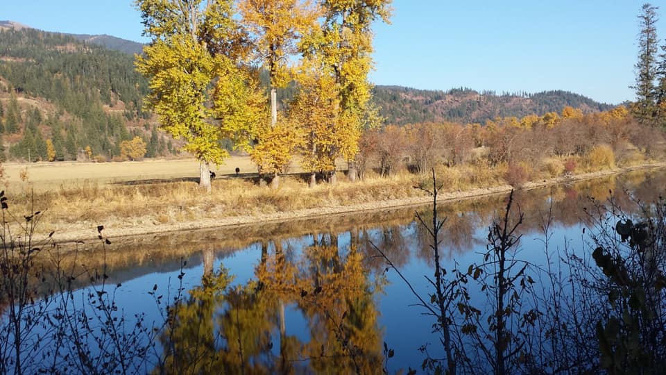
Submitted by Jayme Kachelmier
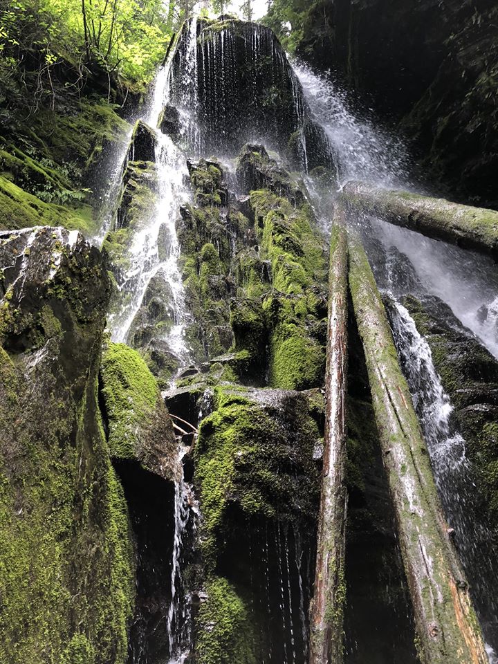
Submitted by Harvey Photography
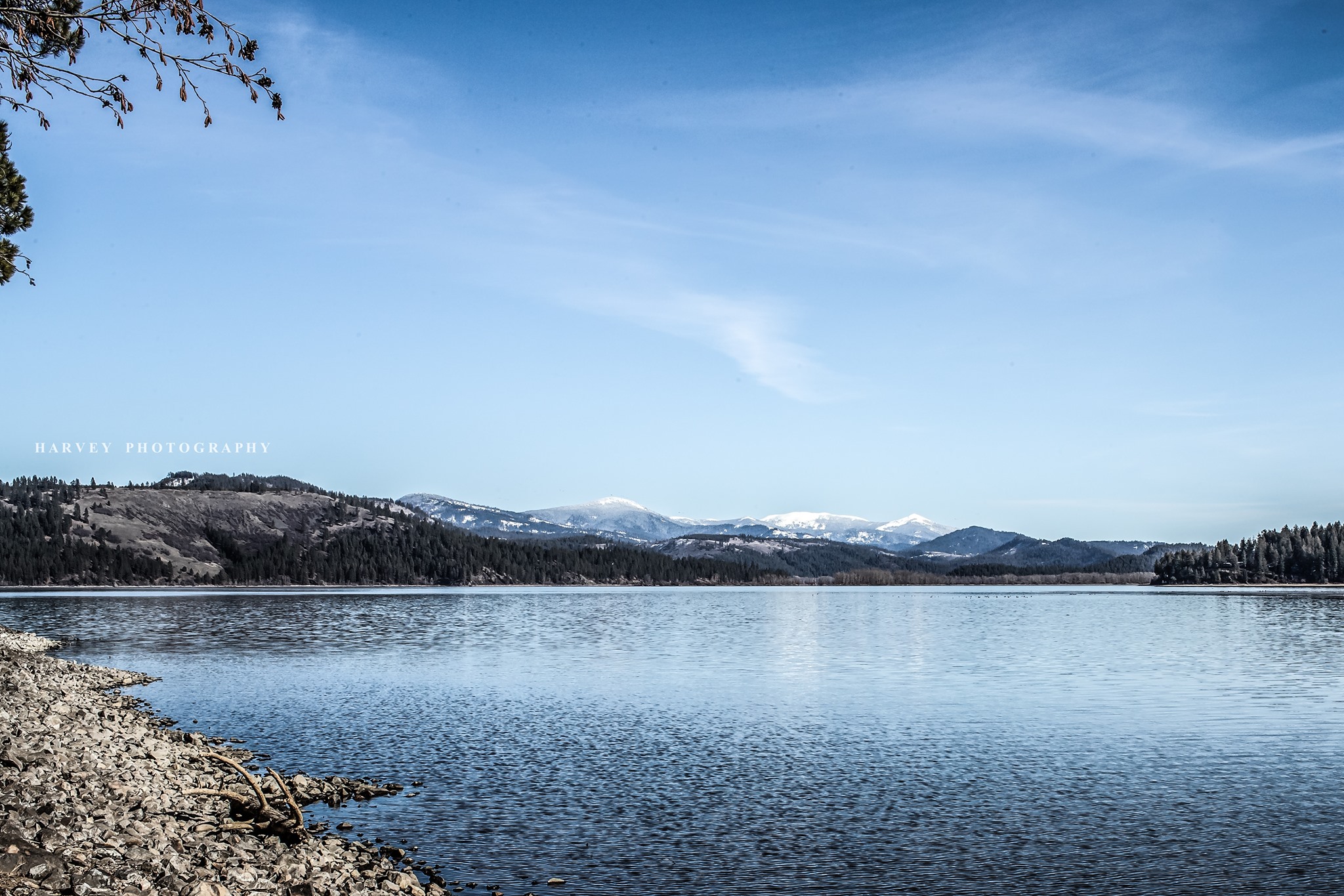
Submitted by Harvey Photography
Submitted by Harvey Photography


EXPLORE WITH US.
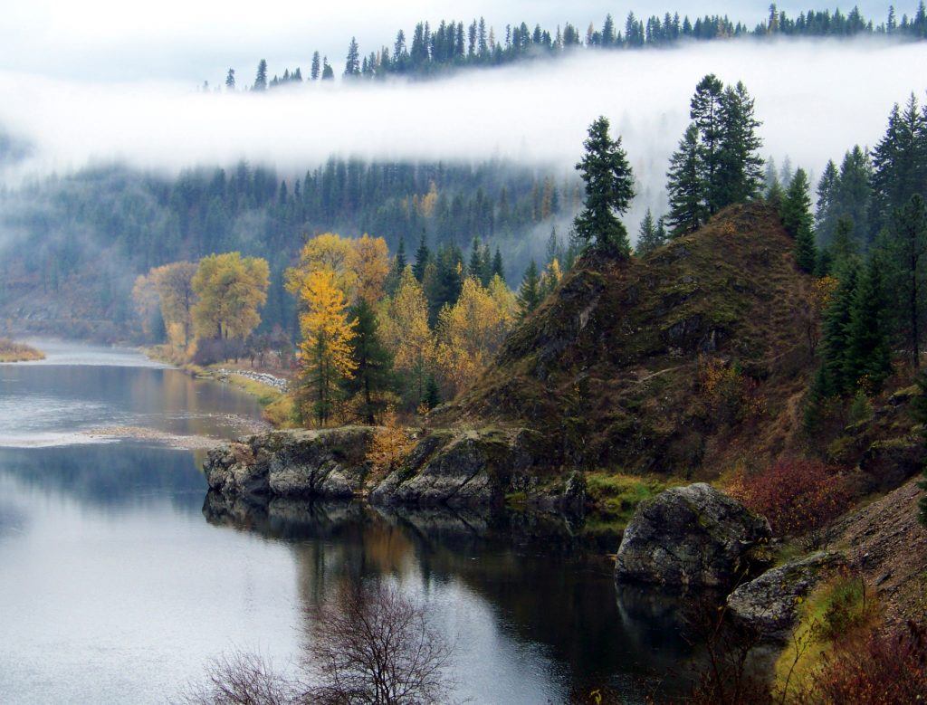
The St. Joe River, more famously known as the “shadowy St. Joe,” is one of the region’s finest for the whitewater, fishing, swimming, camping and hiking it offers. It flows from the high mountains into Lake Coeur d’Alene, with 60 miles of the river above Avery part of the National Wild and Scenic River system; about 30 miles of these upper stretches offer premier whitewater rafting or kayaking during the spring run-off season. The river is renowned as well among fly fishermen, and with literally dozens of parks and trails throughout the basin there is excellent camping, picnicking and hiking.
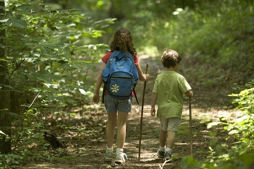
Parks, beaches and trails: Campgrounds along the river or in the basin are numerous, and many are free. The Shadowy St. Joe campground, 10 miles east of St. Maries, is one of the most popular, but many more stretch upstream. For hikers, there are dozens of choices as well.
Boating: Motorized boating is possible from Coeur d’Alene Lake upstream. There is a boat launch at the Shadowy St. Joe campground. Upstream, the action is whitewater during the spring season. There are at least three runs in the Class II-IV range, meaning they require advanced padding skills. River outfitters including ROW Adventures out of Coeur d’Alene offer guided trips.
Wildlife: North Idaho’s full complement of wildlife can be spotted along the St. Joe or within the basin. Big game including moose, elk, deer, bear and waterfowl of all types inhabit the basin, making it a prime region for hunters.
Fishing: Fishermen in the upper stretches are often after cutthroat trout and mountain whitefish, although other species include bull trout, rainbow and brook trout. The lower river to its confluence with Coeur d’Alene Lake has largemouth and smallmouth bass, northern pike, yellow perch and other species.

Saint Maries River is a river located in the U.S. state of Idaho. It is a tributary of Coeur d'Alene Lake and thus part of the Spokane River drainage basin and the Columbia River Basin. The West and Middle Forks of the river join near Clarkia, Idaho and run parallel to State Highway 3 in a northwesterly direction to St. Maries. The area is on the eastern edge of the Columbia River Plateau and is to the west of the Bitterroot Mountains. The river's discharge is estimated at 583 cubic feet per second at its mouth in the town of St. Maries Idaho.
Saint Maries River flows through Benewah County, Idaho and Shoshone County, Idaho

Additional Links & Resources
Several boat ramps, including one at St. Maries Aqua Park, make it easy to launch your boat on the St. Joe River. A day on the water can include kayaking, white water rafting, water skiing or cruising on the St. Joe, St. Maries River, Lake Chatcolet or Round Lake.

Additional Links & Resources
In 1902, this log house was built as the St. Maries Men’s Club, but the organization proved short-lived. In 1906, the building was turned into a doctor’s office and remained in operation until the early 1920s when the business was foreclosed. Noting that the building was rapidly deteriorating, Raleigh
Hughes purchased the house in 1926 and lovingly restored it. The home remained in private possession until 1989 when the Centennial Committee purchased the home and opened it as the Historic Hughes House Museum in 1990. Inside, visitors will catch a glimpse of St. Maries’ younger days. Several photos, antiques, and artifacts depict early life in St. Maries and northern Idaho.
Please call for additional information concerning hours of operation, as the museum is open on a volunteer-available basis. Phone 208-245-3212.
Additional Links & Resources
Logger's Memorial Park bears the names of over 250 St. Joe area loggers that have lost their lives in the logging industry. Planning for the memorial began in 1999; actual construction of the site was completed in 2005. The project was funded entirely by donations of materials, money and labor. The annual botanic display is orchestrated by volunteers from the Benewah County Master Gardeners.

John Mullan the Army officer who in 1859-1862 surveyed and built the Mullan Road from Walla Walla, Washington to Fort Benton, Montana.
The road was to connect the Missouri and the Columbia, and Congress approved in 1855. Indian troubles and lack of funds delayed the job, but the road was completed in 1862. The first route in 1859 had passed about 6 miles west of here, but floods had forced a change, and the final road passed north of Coeur d’Alene lake. Modern Interstate 90 follows Mullan’s final route.

Additional Links & Resources
-
Hughes House Historical Museum (VisitNorthIdaho.com)
-
Hughes House Historical Museum (HMdb.org)
The Marble Creek Historical Site features accessible display shelters, 8 picnic sites, vault toilets, and potable water. Attractions include displays of early 1900s logging, photos, artifacts, and a replica logging flume

Additional Links & Resources
St. Maries is home to family friendly parks for everyone to enjoy.
- Eleanor Park
- St. Maries City Park
- St. Maries City Swimming Pool
- Hill Crest Park

Library Information
Our Hours:
- Monday 10am – 5pm
- Tuesday 12pm – 7pm
- Wednesday 12pm – 5pm
- Thursday 12pm – 7pm
- Friday 12pm – 5pm
- Saturday & Sunday – CLOSED
Directions:
822 College Avenue St. Maries Idaho
The St. Maries Public Library is located one block up from downtown St. Maries, at 822 College Ave.
Contact:
Phone: (208) 245-3732 or use our email form.

Heyburn State Park is the oldest park in the Pacific Northwest. Created in 1908, it is comprised of approximately 5,500 acres of land and 2,300 acres of water. The park includes three lakes; Chatcolet, Benewah, and Hidden Lakes, with the shadowy St. Joe River meandering along the eastern boundary of the park.
Heyburn is a natural park with a variety of different habitats. Large, tall Ponderosa pines tower over grassy hillsides covered in wildflowers. On shadier slopes, cedar trees mix with hemlocks and huge white pines. On the edges of the lakes, the wetland/marsh areas are home to many types of wildflowers and plants.

Additional Links & Resources
-
Heyburn State Park (Idaho Parks & Recreation)
-
Heyburn State Park (Google Maps)
-
Heyburn State Park (Wikipedia)
-
Heyburn State Park (ReserveAmerica.com)
-
Heyburn State Park (StateParks.com)
-
Heyburn State Park (VisitNorthIdaho.com)
-
Heyburn State Park (VisitIdaho.org)
-
Heyburn State Park (IdahoCampgroundReview.com)
Cherry Bend boater’s park is an excellent picnic location and home to many community events.

Additional Links & Resources
The Benewah County Fair is held in August every year in the beautiful North Idaho town of Saint Maries. We are proud of our small country fair in this beautiful setting. Please come and join us!
- Camping
- Arena
- Judd Building
- Walker Building

Additional Links & Resources
Lake Coeur d'Alene Scenic Byway
- Location: Begins at the junction of Interstate 90 and Idaho 97 and follows Idaho 97 south and east along Lake Coeur d’Alene to Idaho 3.
- Length: 35.8 miles. Allow 1.5 hours.
- Roadway: Idaho 97 is a two-lane, winding road with few passing lanes.
- When To See It: Year around. Eagle watching is great in December and January between Wolf Lodge Bay and Beauty Bay.
- Special Attractions: Lake Coeur d’Alene; Mineral Ridge Trail at Beauty Bay; Caribou Ridge National Recreation Trail; Blackwell Island boat launch/recreation site; Trail of the Coeur d’Alenes.
- Camping: Beauty Creek east of Beauty Bay, Bell Bay near Harrison, city of Harrison.
- Services: Partial services in Carlin Bay and Squaw Bay. Full Services in Harrison and Coeur d’Alene
St. Joe River Scenic Byway
- Location: From St. Maries at the junction of Idaho 3 and Forest Hwy 50 (FS 50), east along the St. Joe River for 75 miles. At the junction with Road 218, FS 50 heads north (left) and climbs 14 miles to the Idaho-Montana border.
- Length: 89 miles. Allow 2.5 to 3 hours one way.
- Roadway: Two-lane paved road with numerous pull-outs and points of interest along the way.
- When to see it: Year around from St. Maries to Avery (47 miles). The 42 miles from Avery to the Idaho border is usually open from May through November. During the winter, this section is a snowmobile route.
- Special attractions: Falls Creek waterfall; Marble Creek historic site and picnic area; Avery Ranger Station; Avery Museum; Upper Landing Picnic area; Idaho Panhandle National Forest; St. Joe Wild and Scenic River; breathtaking scenery; blue ribbon fishery; white water rafting; and the Hiawatha Rails to Trails is near by.
- Camping: Private facilities are available in and around St. Maries and Avery; Shadowy St. Joe Campground and Huckleberry Campground are located along the lower, slower moving St. Joe River; Pack Saddle; Turner Tin Can and Conrad Crossing campgrounds are upstream from Avery along the Wild and Scenic St. Joe; and numerous undeveloped campsites along the river
- Services: Full services are available in St Maries and Avery, and partial services in Calder.
White Pine Scenic Byway
- Location: From the junction of Interstate 90 and Idaho 3, south on Idaho 3 to Idaho 6, then southwest to U.S. 95 at Potlatch.
- Length: 82.8 miles. Allow 2 hours.
- Roadway: Idaho 3 and Idaho 6 are both two-lane roads with no passing lanes.
- When to see it: Year around
- Special attractions: Old Mission State Park; Coeur d’Alene River Wildlife Management Area; St.. Joe National Forest; Palouse Divide Nordic Ski Area (“Park and Ski” cross country area); Trail of the Coeur d’Alenes; Potlatch historic walking tours; Mullan Trail Park, Steam Donkey, 1910 Fire Memorial and historical murals in St. Maries.
- Camping: Laird Park, Giant White Pine Park north of Harvard, Pines RV and Camping in Harvard; Scenic 6 RV Park in Potlatch; Heyburn State Park, Benewah County Fairgrounds, Shady River RV Park in or near St. Maries.
- Services: Full services in St. Maries; partial services in Potlatch.

