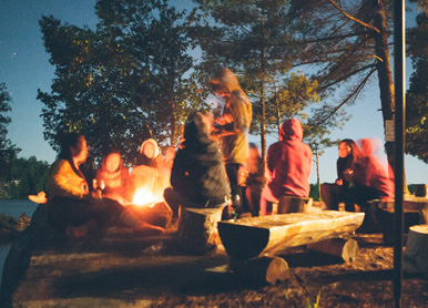

Some will confirm there is no better selection of camping sites than in the St. Joe Valley and along the St. Maries River. From the shores of Coeur d’Alene Lake to the mountains that line the St. Joe River and St. Maries River Valley, there’s no better place to be when it comes to sleeping under the stars, pitching a tent or parking the motor home.
Visitors are encouraged to call the Forest Service for information regarding camping at Forest Service campgrounds, 208-245-2531.
CAMPGROUNDS IN & AROUND ST. MARIES:
HEYBURN STATE PARK
With miles of hiking and bicycle trails, lake access for boaters and waterfowl hunter and abundant wildlife, Heyburn State Park remains a prized possession of Idaho’s residents and visitors alike. Created in 1908, the park is the oldest in the northwest. The 100-yesr-old park was named in honor of Senator W.B. Heyburn of Idaho who was instrumental in the acquisition of the park, created from the Coeur d’Alene Indian Reservation by an act of Congress on April 20, 1908. The deed, signed by President William Howard Taft, granted 5,505 acres of land and 2,333 acres of water to the state.
Three lakes and a river, Chatcolet, Benewah and Hidden lakes and the shadowy St. Joe River are included within the park’s boundaries. Chatcolet Lake is a small area at the southern tip of Coeur d’Alene Lake. It was once a lake by itself, but the dam at Post Falls turned it into part of the bigger, better-known Coeur d’Alene. It also has the added feature of having the St. Joe River in its midst.
The park has a lot to offer; tour the Trail of the Coeur d’Alenes or plan an afternoon picnic. The park has four group picnic shelters built by the Civilian Conservation Corps, three of which can be reserved for an event ($35 plus tax) by contact park staff at 208-686-1308.
There is a $5 fee assessed per day, per vehicle, and annual passports are available for $40 per calendar year.
PLUMMER/WORLEY
Soaring Hawk RV Resort, Plummer: The campground is located at 3201 Hwy 5 in Plummer. With 100 RV sites, they have room for RVs of all sizes. The impressive Kolar Lodge is a beautiful wedding venue, as well as a wonderful place to relax. Open April to October for camping, and long term sites are available through the winter. https://www.soaringhawkrvpark.com/
Praeder Ranch Resort, Worley: The resort is located at 30400 S Sunray Trail in Worley. Close to Conkling Marina and Heyburn state Park, this property features 65 full hookup RV sites, an 11 room lodge, swimming pools, sports courts, and more. Open year-round. https://praederranchresort.com/
CLARKIA AREA
Cedar Creek Campground, Clarkia: Three miles north of Clarkia on State Three. There are three camp sites three picnic sites, vault toilet, no drinking water. Fee: $6 for camping. Day Use free. Fishing in the St. Maries River.
Emerald Creek Campground, Clarkia: The campground is located near the Emerald Creek Garnet Area. Hobo Cedar Grove and Lines Creek Interpretive Trails for day trips from the campground. Take State 3 south from Fernwood, six miles to Emerald Creek Rd. 447. Turn right and follow the signs 4.8 miles to the campground. Open May 15 to Sept.15. 18 Campsites, drinking water, vault toilets, rock-hounding.
ST. JOE RIVER
Misty Meadows Campground, St. Maries: Take State Three out of St. Maries .6 mile to the St. Joe River Rd, and go 3 miles East on St Joe River Rd. With 40 spots along the river, they have spaces with water and electricity. No reservations accepted. They have ample overflow parking in the event that their spaces are full.
Shadowy St. Joe Campground, St. Maries: Take State Three out of St. Maries .6 mile to the St. Joe River Rd. Drive 10.8 miles east to campground sign. Fourteen Campsites, wheelchair accessible, drinking water, vault toilets, boat ramp and docks, fishing. Fee: $6, Day Use free. Picnic Shelter(can be rented for groups)
Scott Park: This RV and boat campground is about 14 miles east of St. Maries up the St. Joe River Road at milepost 14 near St. Joe City. There is a fire pit, picnic table, boat launch and camping by donation. Pack in/pack out. Outhouse, no drinking water.
Huckleberry, Calder: BLM campground five miles east of Calder on the St. Joe River; 39 RV sites; 50′ maximum length. Open April 1 to Nov. 30. Pull through sites, hookups, drinking water, handicap access, vault toilets, pets allowed, dump station included. Boating, fishing, river rafting. Tents welcome.
Marble Creek Interpretive Site, St. Maries: 35 miles east of St. Maries on St. Joe River Rd. FH-50. Five picnic sites, displays tell the story of early logging in the Marble Creek drainage. Six picnic tables and vault toilets. Fishing access. Wheelchair accessible site.
Upper Landing Picnic Area: One mile east of Avery on St. Joe River Road (FH-50) picnic shelter with 6 tables and 4 other picnic sites, info kiosk, water, fishing and hiking. Adjacent RV dump station.
Packsaddle Campground, Avery: Six miles east of Avery on St. Joe River Road. Two sites for tents/campers, with vault toilet, hiking, fishing and rafting. No water.
Turner Flat, Avery: Eight miles east of Avery on the St. Joe River Rd. Eleven campsites, drinking water, vault toilets, hiking, fishing, rafting. Stock allowed in two sites with feed bunks. Fee: $6
Tin Can Flat, Avery: Ten miles east of Avery on the St. Joe River Rd. Eleven campsites. Drinking water, vault toilets, hiking, fishing, kayaking, rafting. Fee: $6
Conrad Crossing, Avery: Twenty-eight miles east of Avery on the St. Joe River Rd. (FS Rd. 50). Eight Campsites, drinking water, vault toilets, hiking, fishing, rafting.
Gold Flat Camping Area: Meadow camping area, good for groups. Vault toilet, fishing, hiking. No water.
Fly Flat Campground, Avery: Pack in/pack out campground 29 nine miles east of Avery on the St. Joe River Rd. Turn right across the bridge on Red Ives Rd. 218 and go 3.4 miles to campground, 14 campsites. One pull-through stock only site and stock allowed in five other sites. The Red Ives visitor center and historical site is seven miles away. Drinking water, vault toilets, hiking, fishing, kayaking.
Beaver Creek Campground: Twenty-nine miles east of Avery on the St. Joe River Rd., then 8 miles on Red Ives Rd. 218. Two tent/camper/small trailer campsites, vault toilet, fishing, hiking. No water.
Red Ives Ranger Station: Twenty-nine miles east of Avery on the St. Joe River Rd., then 10 miles on Red Ives Rd. 218. Visitor information, water, vault toilet. The station is on the National Historic Register.
Line Creek Stock Camp, Avery: Twenty-nine miles east of Avery on the St. Joe River Rd., then 11 miles on Red Ives Rd. Nine pull-through units for stock trailers. Feed bunks, hitch posts, vault toilets, hiking, fishing. No drinking water.
Spruce Tree Campground, Avery: Twenty-nine miles east of Avery on the St. Joe River Road, then 12 miles on Red Ives Rd. Nine campsites, drinking water, vault toilets, hiking, fishing. End of the road and the start of St. Joe River Trail 48.
UPPER ST. JOE AREA
Heller Creek Campground: 13 miles east of Red Ives Ranger Station on high clearance Road 320. Four campsites, vault toilet, fishing, hiking (St. Joe Lake Trail 49), historic Heller gravesite and sign. No water.
Mammoth Springs Campground: 22 miles east of Avery on St. Joe River Road FH-50, then 14 miles south on Bluff Creek Road 509, turn south 2.5 miles on Road 201. Six campsites, vault toilets, drinking water, stock area and water trough, vault toilet. Hiking, one mile from Dismal Lake, approx. 5 miles from Snow Peak Trailhead.
BIG CREEK AREA
Big Creek Campground, Calder: Five miles east of Calder on County Rd. 347; four miles northwest on Big Creek Rd. 537. Nine Campsites, vault toilets, drinking water, fishing, hiking, dirt bikes, horseback trails.
CCC Camp, Calder: Five miles east of Calder on County Rd. 347; three miles northwest on Big Creek Rd. 537. Meadow camping area, good for groups. Vault toilet,fishing, hiking, dirt bikes, horseback trails. No water.
NORTH FORK ST. JOE
Telichpah Campground, Avery: (formerly North Fork Joe Campground) Six miles north of Avery on the North Fork of the St. Joe Rd. (FS Rd. 456). Fifteen campsites, five that can accommodate trailers/RVs. Ten sites for tents and pick-up campers. Vault toilets, no potable water. Hiawatha Bicycle Trail Hiking, fishing.
MARBLE CREEK AREA
Camp 3 Campground: 35 miles east of St. Maries on FH-50, then 15 miles south (left) on Marble Creek Road 321. Four campsites, stock area, vault toilet, historic cabin. No water.
Hobo Historic Trail: 35 miles east of St. Maries on FH-50, then 18 miles south (left) on Marble Creek Road 321. Vault toilet, trail with interpretive signs, steam donkey, and other artifacts.


