
Location: Begins at the junction of Interstate 90 and Idaho 97 and follows Idaho 97 south and east along Lake Coeur d’Alene to Idaho 3.
Length: 35.8 miles. Allow 1.5 hours.
Roadway: Idaho 97 is a two-lane, winding road with few passing lanes.
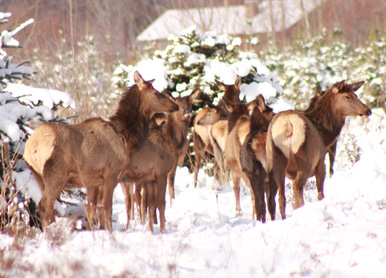
When To See It: Year around. Eagle watching is great in December and January between Wolf Lodge Bay and Beauty Bay.
Special Attractions: Lake Coeur d’Alene; Mineral Ridge Trail at Beauty Bay; Caribou Ridge National Recreation Trail; Blackwell Island boat launch/recreation site; Trail of the Coeur d’Alenes.
Camping: Beauty Creek east of Beauty Bay, Bell Bay near Harrison, city of Harrison.
Services: Partial services in Carlin Bay and Squaw Bay. Full Services in Harrison and Coeur d’Alene.
Location: From St. Maries at the junction of Idaho 3 and Forest Hwy 50 (FS 50), east along the St. Joe River for 75 miles. At the junction with Road 218, FS 50 heads north (left) and climbs 14 miles to the Idaho-Montana border.
Length: 89 miles. Allow 2.5 to 3 hours one way.
Roadway:Two-lane paved road with numerous pull-outs and points of interest along the way.
When to see it: Year around from St. Maries to Avery (47 miles). The 42 miles from Avery to the Idaho border is usually open from May through November. During the winter, this section is a snowmobile route.
Special attractions: Falls Creek waterfall; Marble Creek historic site and picnic area; Avery Ranger Station; Avery Museum; Upper Landing Picnic area; Idaho Panhandle National Forest; St. Joe Wild and Scenic River; breathtaking scenery; blue ribbon fishery; white water rafting; and the Hiawatha Rails to Trails is near by.
Camping: Private facilities are available in and around St. Maries and Avery; Shadowy St. Joe Campground and Huckleberry Campground are located along the lower, slower moving St. Joe River; Pack Saddle; Turner Tin Can and Conrad Crossing campgrounds are upstream from Avery along the Wild and Scenic St. Joe; and numerous undeveloped campsites along the river
Services: Full services are available in St Maries and Avery, and partial services in Calder.
Whom to call:
St. Maries Chamber of Commerce
(208)245-3563
www.stmarieschamber.org
St. Joe Ranger District, St. Maries Office
(208) 245-2531
Avery Office:
(208) 245-4517
www.fs.fed.us
Bureau of Land Management: www.blm.gov
Location: From the junction of Interstate 90 and Idaho 3, south on Idaho 3 to Idaho 6, then southwest to U.S. 95 at Potlatch.
Length: 82.8 miles. Allow 2 hours.
Roadway: Idaho 3 and Idaho 6 are both two-lane roads with no passing lanes.
When to see it: Year around
Special attractions: Old Mission State Park; Coeur d’Alene River Wildlife Management Area; St.. Joe National Forest; Palouse Divide Nordic Ski Area (“Park and Ski” cross country area); Trail of the Coeur d’Alenes; Potlatch historic walking tours; Mullan Trail Park, Steam Donkey, 1910 Fire Memorial and historical murals in St. Maries.
Camping: Laird Park, Giant White Pine Park north of Harvard, Pines RV and Camping in Harvard; Scenic 6 RV Park in Potlatch; Heyburn State Park, Benewah County Fairgrounds, Shady River RV Park in or near St. Maries.
Services: Full services in St. Maries; partial services in Potlatch.
Whom to call:
St. Maries Chamber of Commerce
(208) 245-3563
www.stmarieschamber.org
Idaho Panhandle National Forest
(208) 245-2531
Old Mission State Park
(208) 682-3814
Potlatch City Hall
(208) 875-0708
www.potlatchidaho.org
Coeur d’Alene Area Chamber of Commerce
(208) 664-3194 or
[email protected] - coeurdalene.org


